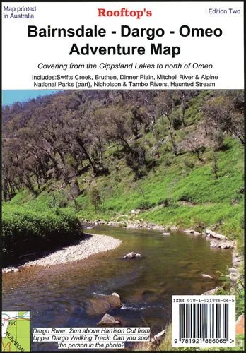
East Gippsland Regional Map
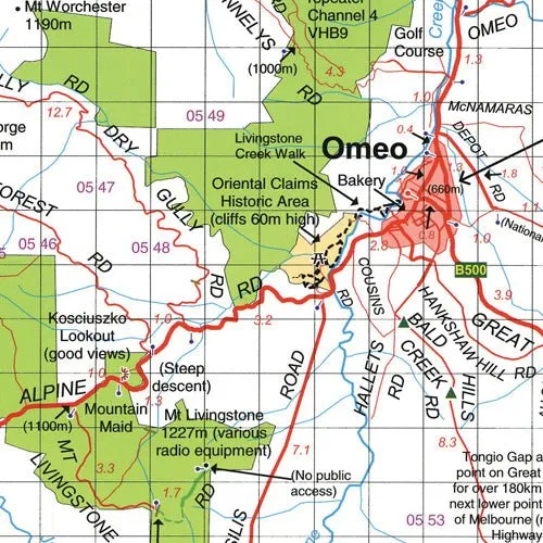
This detailed double-sided map showcases Victoria’s picturesque East Gippsland region, covering key destinations from Paynesville, Metung, and Lakes Entrance in the south to Dinner Plain, Omeo, and Mount Nugong in the north. Whether you’re exploring the serene Mitchell River National Park, the historic town of Dargo, or the enchanting Haunted Stream, this map is your ultimate guide to the region.
Features
- Covers Paynesville, Metung, and Lakes Entrance in the south
- Extends north to Dinner Plain, Omeo, and Mount Nugong
- Includes key locations such as Dargo, Mitchell River National Park, Swifts Creek, Cobungra, Victoria Falls, and Cassilis
- Highlights historic and scenic spots like Deptford, Bullumwaal, Mount Baldhead, and Haunted Stream
- Perfect for touring, hiking, and discovering East Gippsland’s natural beauty
Specifications
- Edition: Latest
- Scale: Detailed touring scale
- Folded Size (WxHxD): 140mm x 250mm x 3mm
- Flat Size (WxH): 700mm x 1000mm
- Weight: 0.09kgs
This map is ideal for adventurers and travellers looking to explore East Gippsland’s rich landscapes and historic sites. Whether you’re navigating scenic routes, hiking through national parks, or discovering hidden gems, this map provides all the details you need for a memorable journey.
About the Publisher:
Renowned for their detailed and reliable maps, this publisher combines precision and usability to create products trusted by travellers and outdoor enthusiasts. Their maps are designed to help you confidently explore Australia’s diverse regions.
![Kent Search and Rescue "SAR" Commercial Vest - XXXLarge [150400-200-070-12]](https://www.jeanfitbelt.shop/image/kent-search-and-rescue-quotsarquot-commercial-vest-xxxlarge-150400-200-070-12_0ZeYYA_300x.webp "Kent Search and Rescue \"SAR\" Commercial Vest - XXXLarge [150400-200-070-12]")
")


